
Weather Outlook for Dominica and the Lesser Antilles
Valid from: 6:00 AM on Thursday, September 7, 2017
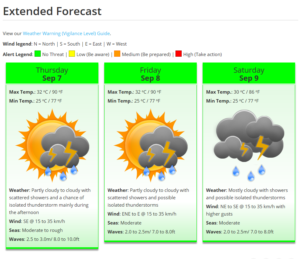
Lingering moisture and instability associated with the passage of Irma will continue to produce cloudiness, scattered showers and isolated thunderstorms across parts of the island chain during the next 24 hours.
Persons in areas prone to flooding, landslides and falling rocks are advised to continue to exercise caution.
Meanwhile, at 5 am, Hurricane Jose was located near latitude 14.8 degrees north and longitude 49.1 degrees west or about 815 miles east of the Lesser Antilles.
Interests in the Leeward Islands should monitor the progress of Jose and make all the necessary preparations as it is expected to be near the area by Friday into Saturday. Hurricane and Tropical Storm Watches will likely be required for some of these islands later this morning.
Moderate to rough seas are expected during the next 12 to 24 hours with waves peaking near 8.0 feet. As a result, a small craft warning remains in effect for above normal seas.
From the Dominica Meteorological service.


For seasonal outlook and more, please click on the link provided.
http://www.weather.gov.dm/